Mountain Adventure Holidays


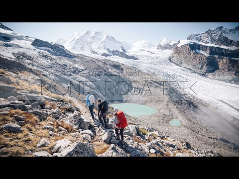
The Tour of Monte Rosa is one of the Alps’ most spectacular and challenging multi-day walks. Trek through the dramatic Pennine Alps, straddling Switzerland and Italy, beneath some of the highest peaks in the Alps - including the towering Dufourspitze, the iconic Matterhorn, and the jagged Weisshorn.
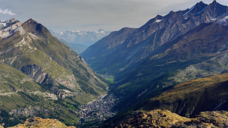
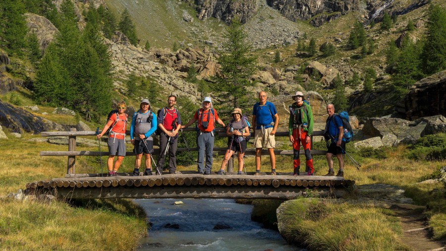
This route circles the Monte Rosa Massif, following ancient trails through pine forests, alpine meadows, and hidden valleys, keeping you close to cliffs, glaciers, and jaw-dropping mountain scenery. Along the way, experience the buzz of the world-famous alpine town of Zermatt.
A must for hikers who crave stunning summits, exciting terrain, and an unforgettable high-mountain adventure.
Your guide will meet your guide, at approximately 1800 hrs, in the town of Saas Grund Switzerland. The guide will brief you on the days ahead and answer any questions you might have about the trip.
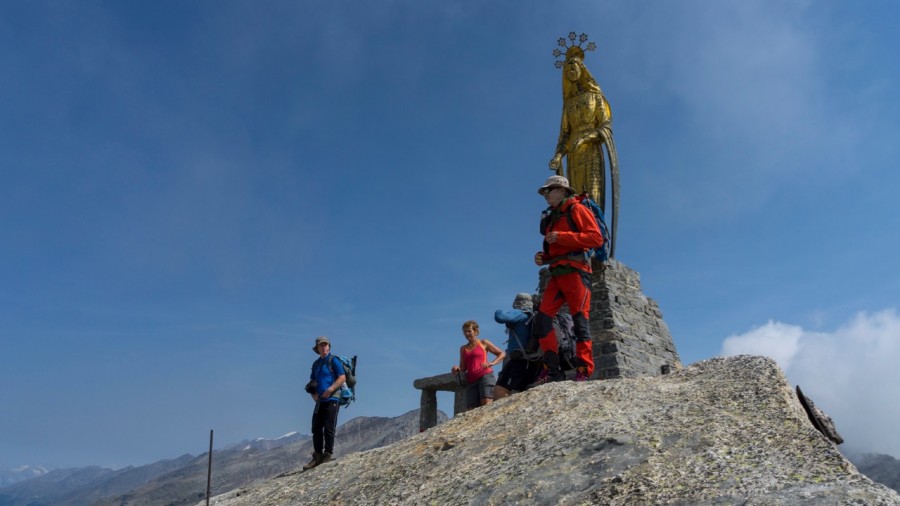
We begin our epic alpine journey the easy way! We jump on the Swiss post bus for a short ride up the valley to our departure point at Mattmark lake. The scenery is breath-taking with glaciers towering above us as we stroll along the lake side. After this easy warm up, we start the climb to our first major col of the trip, the Monte Moro pass which sits at 2853m (9357ft). Historically the Monte Moro is an important border crossing between the valleys of Saas in Switzerland, and Macugnaga in Italy. There is a golden Madonna statue to welcome us at the frontier, and the chance for our first Italian coffee at the Rifugio Oberto Maroli just below. The pass offers our first spectacular views of the Monte Rosa massif, including the two 4000ers the Weissmies at 4023m (13,195ft) and the Rimpfischhorn which reaches 4198m (13,769ft) a just reward for the effort and a perfect photo opportunity. We then have a steep descent to the lovely Walser village of Macugnaga. This remote valley is an experience in itself, with traditional Walser houses and flower strewn balconies.
Ascent: 750m (2460ft) Descent: 1600m (5248ft) Distance: 15km (9.4 miles) Duration: 6h00-8h00
Our trail today goes over the Colle del Turlo on an incredible paved path created by the Italian army in the 1920's. There is s a 'lost' and remote feeling to the valleys we pass through, and it's a clear contender for one of our favourite walks. We leave Macugnaga by following the Anza torrent towards the lake at Quarazza, passing several old wooden chalets before reaching alpine meadows where cow herds are often to be found grazing. Sometimes there is also a cow-herd spending the day with the herds creating an image of what seems like a by-gone era, yet a tradition that is still practiced today. Then there is a steady climb to Alpe Plana with a backdrop of impressive waterfalls. Eventually, we reach the paved trail which zig zags its way up to the pass with military precision. The pass is a jagged rocky notch on the horizon which marks the entrance to the Alagna valley. Monte Rosa is lost from sight, but the view of the impressive white dome of the Weissmies is compensation. From here it's a long descent to our overnight stop at the wonderful Rifugio Pastore.
Ascent: 1510m (4952ft) Descent: 1300m (4264ft) Distance: 23km (14.4 miles) Duration: 7h00-8h00
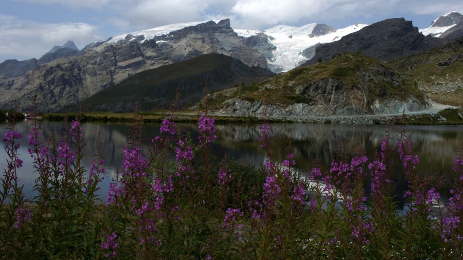
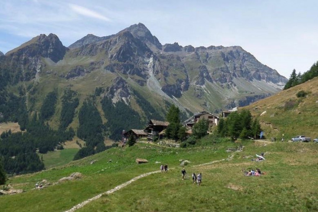
Leaving behind the lovely Rifugio Pastore we follow a trail through the woods to reach Aqua Bianca by the waterfalls, this is the 'stop' for the shuttle bus which we will take down to the lovely town of Alagna. From here we climb through the forests to the truly idyllic hamlets and farming settlements of the Otro valley. A further ascent into a wild valley takes us to the first pass Passo Foric (2432m) and then onwards to our high point of the day at the Col d'Olen (2881m). In 1636 Col d’Olen was the site of a major battle between Spanish and Piedmontese forces, won by the latter despite their heavy losses. The Col then became important during the 19th century as the starting point for mountaineering expeditions up Monte Rosa. After passing the Col we head down to our rifugio at the Gabiet lake which sits at 2375m (7790ft).
If the shuttle bus is not running your leader will take the alternative route from the Rifugio Pastore via the Vallon Delle Pisse and Alpe Pianlunga to the Rifugio Gabiet. In this case we head towards the impressive Pyramid Vincent, one of the smaller peaks of the Monte Rosa Massif, before turning left into the Vallon delle Pisse, an inelegant name for a lovely valley. We may stop for morning coffee at the ancient Rifugio Crespi Calderini, before continuing our route to the Col d'Olen at 2880m (9446ft).
Ascent: 1800m (5904ft) Descent: 600m (1962ft) Distance: 14km (8.7 miles) Duration: 8h00
There is a gorgeous downhill trail through the larch woods to start our day, and then the chance for Italian coffee at we pass through the village of Gressoney. After a break we begin the day's climb to the beautiful and wild Saleroforko pass at 2689m (8819ft). A very efficient zig zag trail climbs the mountain, and before too long we win the col and views to the Val d'Ayas and the towering cliffs on the skyline. The descent from the Saleroforko is through a boulder field, but the trail is well-marked, and then we are on easy ground as we cross the alpine meadows. There is a sting in the tail as we have another short uphill over a broad pass, and then its an easy down through the woods and meadows to the tiny hamlet at Resy. There are some really lovely old stone and wood built traditional buildings here and it does feel like we are perched on the mountainside for the night. We love being here as our rifugio is in a stunning location and an evening drink on the terrace is something to be savoured.
Ascent: 970m (3181ft) Descent: 1200m (3936ft) Distance: 16km (10 miles) Duration: 7h00-8h00
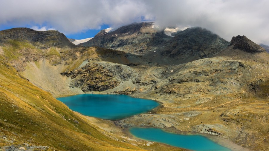
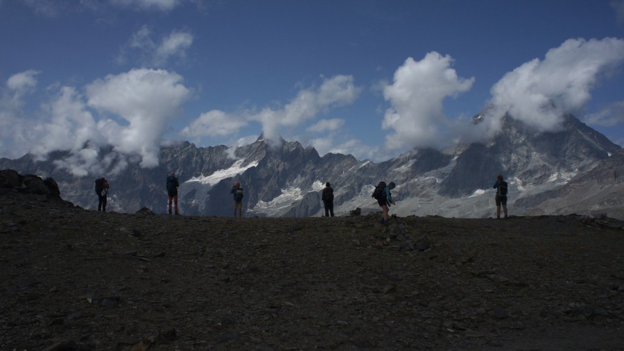
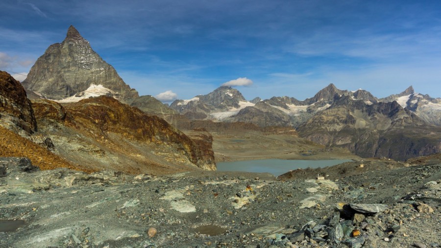
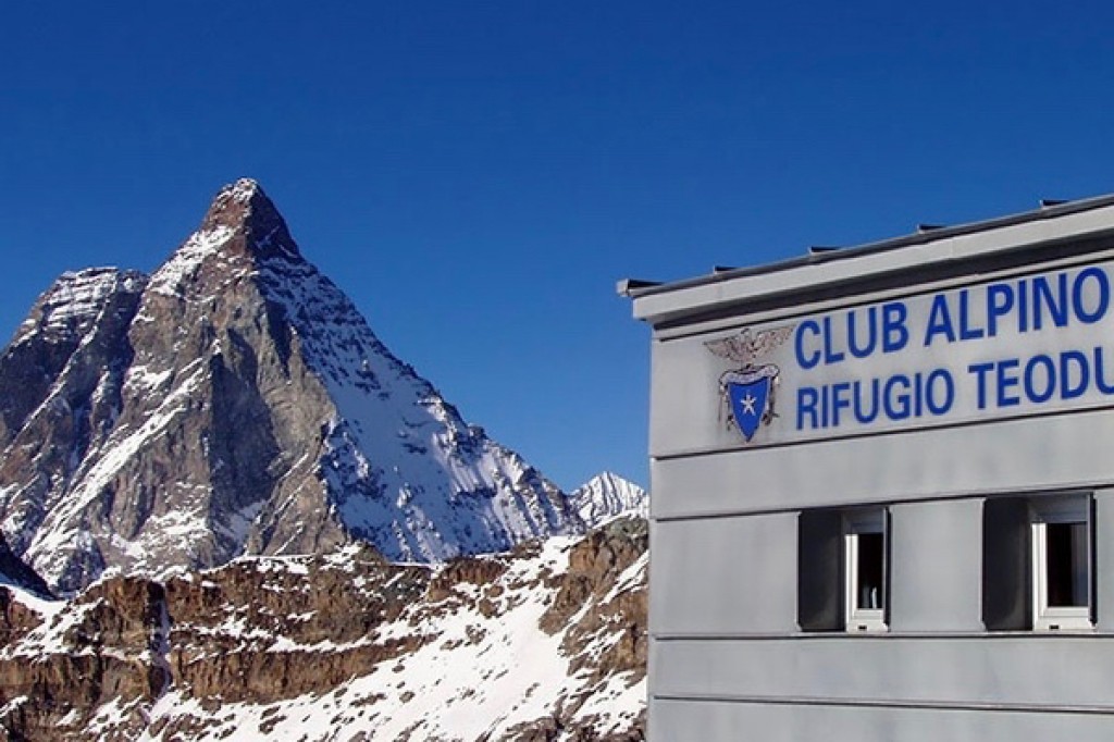
This is one of the highlights of the trek as we begin the day with a wonderful traverse towards the meadows of Alpe Varda and Alpe Mase. Our trail goes through the larch forests until eventually the terrain opens out and high above us lies the glaciated bulk of the Breithorn which is a popular 'easy' alpine route climbed from either Zermatt or Cervinia. We then have the inevitable climb towards the Colle Superieur delle Cimes Blanches which sits at 2982m (9780ft), though en route we pass the green waters of the Gran Lago where we can catch our breath before continuing. From the top of the pass we gain our first views of the Matterhorn at 4478m (14,687ft), an unforgettable moment. This iconic mountain is steeped in legend and history and for those who love the mountains it is a breath-taking moment when you first set eyes on it! Once we have taken the obligatory photos we then drop down through the glacial moraine before our final climb of the day to the impressive Col de Theodule at 3316m (10,876ft) or 'Teodulo' if you are giving the Italian name, and our rifugio for the night. Tonight we have 360 degree views of the Alps, and the Matterhorn on the doorstep. There have to be worse ways to spend the evening!
Ascent: 1550m (5084ft) Descent: 300m (984ft) Distance: 18km (11 miles) Duration: 7h00-8h00
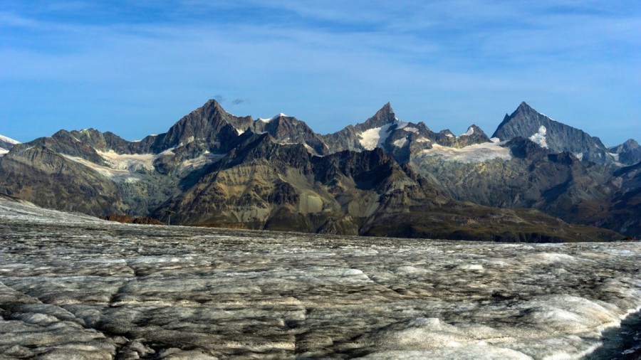
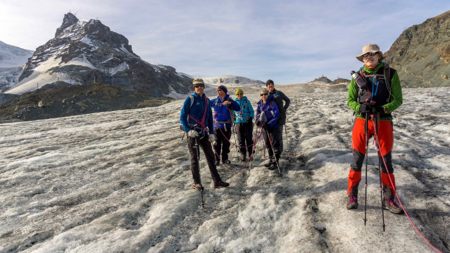
A mostly downhill day today as we descend from the rifugio at 3316m (10,876ft) to Zermatt at 1608m (5274ft) via the Theodule Glacier. The Theodole has various spellings depending if you are on the German speaking side of the col or the Italian speaking side in which case it is the Teodulo! If the weather is good then the early morning light offers fantastic photo opportunities of the big 'M'. The views are superb, with the centrepiece again being the Matterhorn, which is joined by the Alphubel, Dom, Obergabelhorn, Zinalrothorn and Weisshorn on both sides of the Mattertal.
As we will be crossing a glacier this morning you will be guided on this section by an IFMGA qualified guide, in other words a 'high mountain' guide who will join your own guide in leading the group. You will require to be roped together for the crossing, but no specialist equipment or skill is required. It's just a case of walking, and wearing regular hiking boots and using trekking poles. The glacier is very easy angled and in reality you are walking down what in winter is a ski piste.
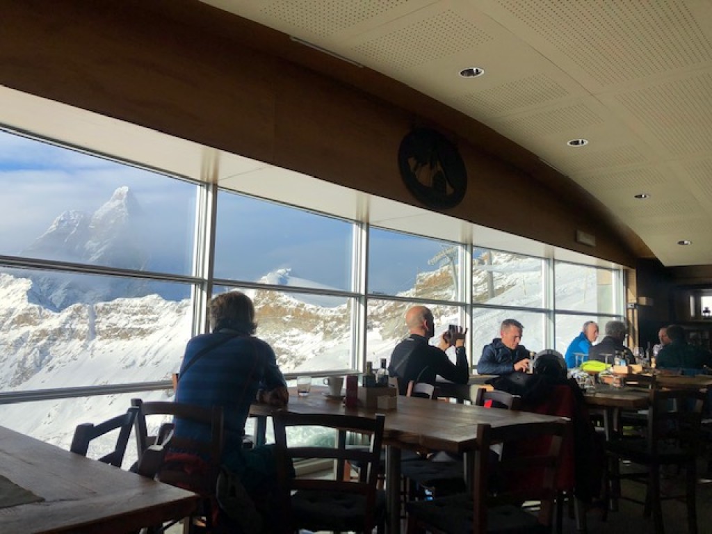
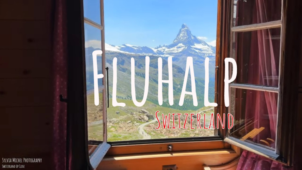
At the hut at Gandegg we leave the ice, say goodbye to our high mountain guide, and traverse glacial moraine as we head down towards the famous alpine town of Zermatt. There is the possibility that you may be able to take a cable car down to gain more time in Zermatt and to save your knees. Please note that the cost of the cable car is not included in your trip fee. After having an opportunity to explore the town we make use of the We begin with a ride on the Sunnegga funicular train folowed by the then a gondola up to Blauherd. From the lift it is a 15 minute walk up past the Stellisee lake which provides great views back over towards the Matterhorn. It is then a final 20 minute walk to your overnight accommodation at the Fluhalp Hut.
Ascent: 250m (829ft) Descent: 1800m (5904ft) Distance: 18km (12 miles) Duration: 6h00
In the morning we retrace our steps to the top of the list station before we traverse on a track until we meet a path above the ancient hamlet of Tufteren. From here we follow the Europaweg trail where we can enjoy some great views of the Matterhorn before we turn our back on the mountain and start our traverse to the Europahutte. By lunchtime we reach the meadows at Taschalp and it is there we continue onto rougher terrain as we head towards the new Charles Kuonen Suspension Bridge which is a staggering 500m long and now famed for being the worlds longest pedestrian suspension bridge. Our trail works its way along under the jagged peaks of the Täschorn and the Dom until we eventually reach the stunningly situated Europahutte at 2220m (7281ft) where the guardian Marcel will be waiting to prepare your dinner. The hut is relatively new and is situated in a really prime position for views of the Weisshorn. A sunset with a beer and the alpenglow setting on the peaks opposite is to be savoured.
Ascent: 815m (2673ft) Descent: 1165m (3822ft) Distance: 19.8km (12.3 miles) Duration: 08h00
Please Note There are sections of todays trail which has considerable exposure and the path is narrow at times. If you feel the trail would be unsuitable you can drop from Tascalp down to Tasche and either use public transport or hike along to the village of Randa before heading up to the Europahutte on a well sign-posted trail. Alternatively you could choose to overnight in Randa and meet up with the group when they descend to the valley the following day. Any variations on our advertised itinerary will be at your own expense.
Today is a challenging, but rewarding day as we leave the Europahutte and begin our journey to the beautiful mountain town of Grächen. Following the closure of the Europaweg trail between the Europahutte and Grächen, we now take a route which begins with a rocky path along the famous Europaweg, but then descends down a gully through larch forest to the village of Randa. On this trail we pass through the truly ancient mountain community of Chüebodmen where the wooden farm buildings are perched in a high summer meadow representing a rural tradition which goes back centuries. Once we reach Randa in the Mattertal we pick up the trail along the river and follow it downstream until we reach the village of Herbriggen where we can enjoy a drink before the steep pull up to our destination. This new footpath gives our legs a good work out, but our reward is our arrival in the quintessential Swiss village of Grachen where the traditional chalets are be-decked with geraniums and other colourful flowers. We usually spend quite a lot of time contemplating the impressive flower and vegetable gardens that line the streets! Like Zermatt, Grächen is a 'car free' town and very characterful.
Ascent: 915m (3001ft) Descent: 1503m (4929ft) Distance: 22.5km (14 miles) Duration: 9h00
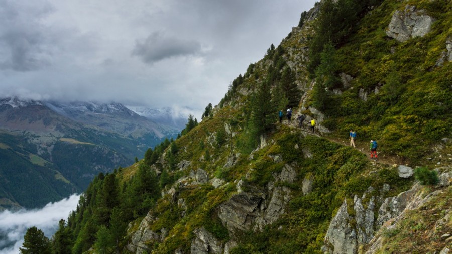
Leaving the sleepy village of Grächen we start a day which is really stunning. We climb at first through very pleasant larch forests to a high meadow at Hannigalp, and then begin what is an extremely fine traversing line towards the Saastal. The trail keeps us focused at all times as it is sometimes narrow, and a little concentration is needed, however, nothing that should worry a seasoned hiker. Although we have dropped in height from the previous few days and there is a greener feel to the countryside, there are still rocky sections to contend with. Today our mountain views have changed and directly ahead now is the snowy summit of the Weissmies and the rocky Lagginhorn. These two well-known mountains continue to dominate our view as we walk what is a beautiful trail across the mountainside. There is lots of variety in terms of the terrain, there is often wildlife such as ibex or chamois, and, of course, the alpine wild flowers. Eventually, we complete our trek full circle back to our starting point at Saas Grund. We will check into our overnight accommodation in Saas Grund for a final, celebratory meal and reflect on accomplishing a walk that is one of the finest and most challenging in the Alps.
Ascent: 1220m (40001ft) Descent: 1270m (4165ft) Distance: 21km (13 miles) Duration: 8h00-9h00
Today is your departure day from Saas Grund. The trip package ends after breakfast.
It is always our aim to complete the proposed itinerary outlined above, however, it may be necessary for our guides/instructors to adjust the daily itinerary based on the weather conditions, group safety and enjoyment.
We always aim to accommodate our guests in well-situated, clean, characterful, family run accommodation. In many cases we have known the management for years, and it’s like visiting friends. Our suggested accommodation, listed below, is subject to availability at the time of booking. We have given details of our favoured venues and those we intend to use. If unavailable we will book alternative accommodation of a similar standard.
Our trip fees are based on two people sharing a room while in the valleys or towns. If you are travelling on your own your booking will be based on a twin bedroom sharing with someone of the same gender, what we call a 'twin' means two single beds in one bedroom. If you are booking as a single traveller you will share with someone of the same gender. In many cases a single room is available for a supplementary fee, but these can be in short supply and require early booking. Note that it is very rare to have air conditioning in European mountain areas, and most bedrooms do not have this facility.
In the more remote and inaccessible sections of the Tour de Monte Rosa the accommodation will be in rifugios (mountain huts) where the accommodation is usually in dormitory rooms. It's normal in the Alps to share accommodation whilst in the mountains and many good friends have been made this way! The rifugios tend to be very characterful and serve tasty local dishes. They are usually situated in stunning locations and the chance to enjoy a beer or glass of wine while watching the sun go down, and the ibex playing on the mountain-side can provide a really special mountain moment. For many of our guests the rifugios literally prove to be a high point of the trip.
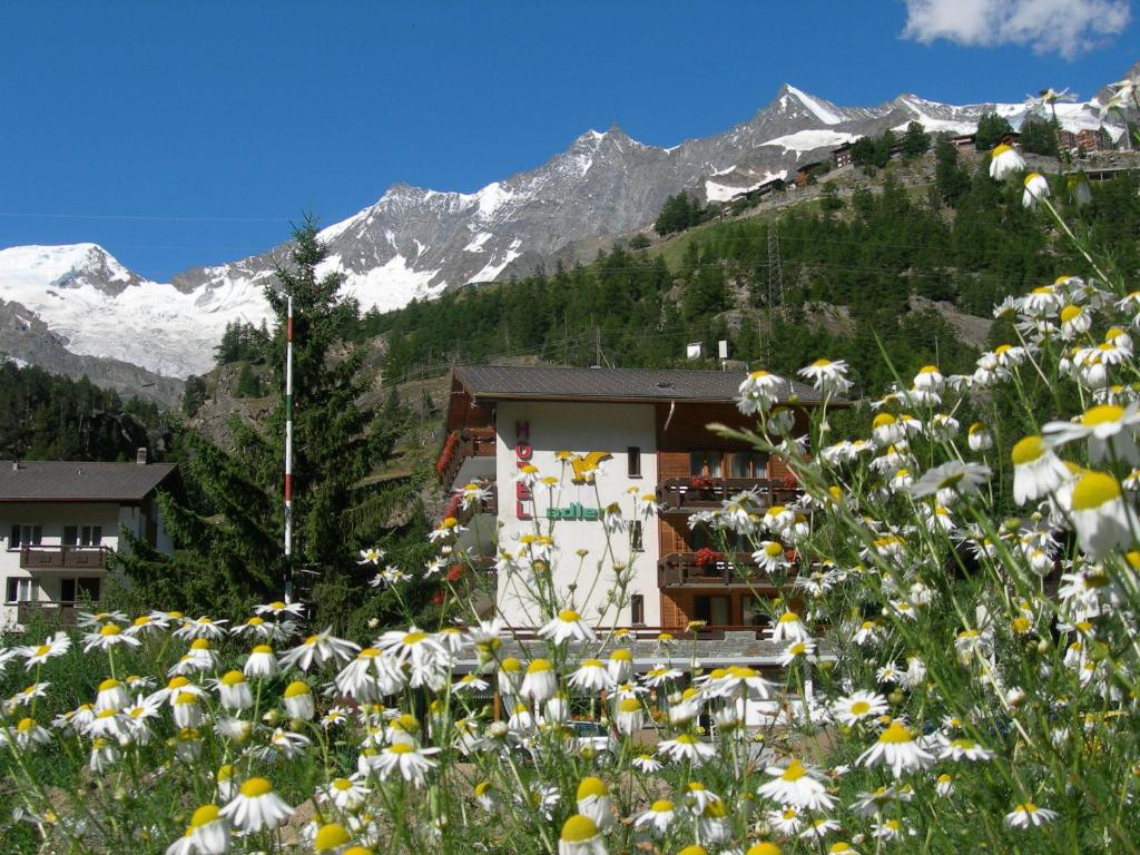
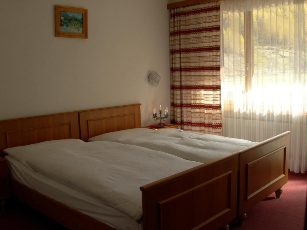
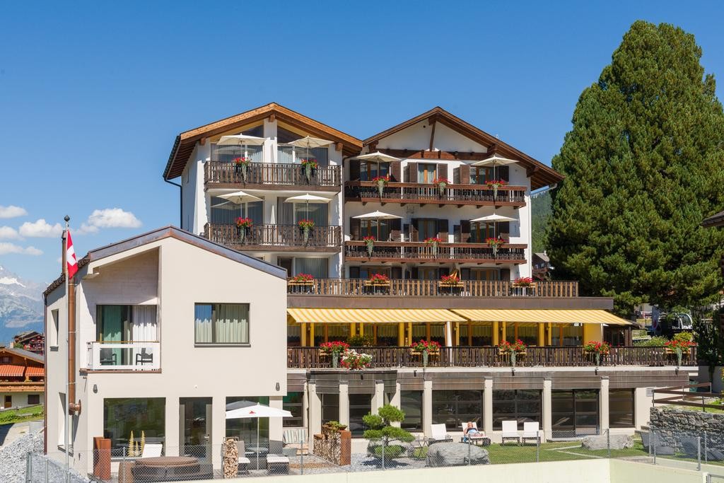
The Hotel Adler is situated near the village of Saas Grund, in the heart of the Saas Valley. This family run hotel is in a quiet location with a view of the Mischabel mountain range. Rooms are en suite with showers and toilet. If you arrive by car there is free parking in front of the hotel.
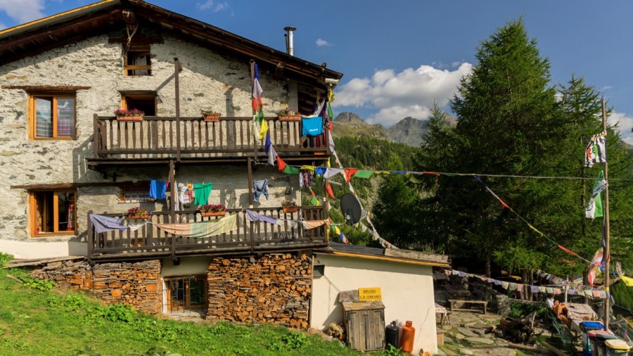
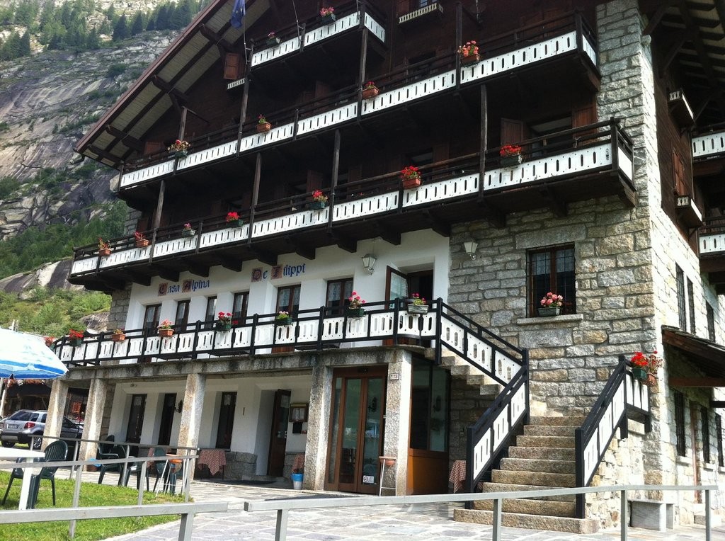
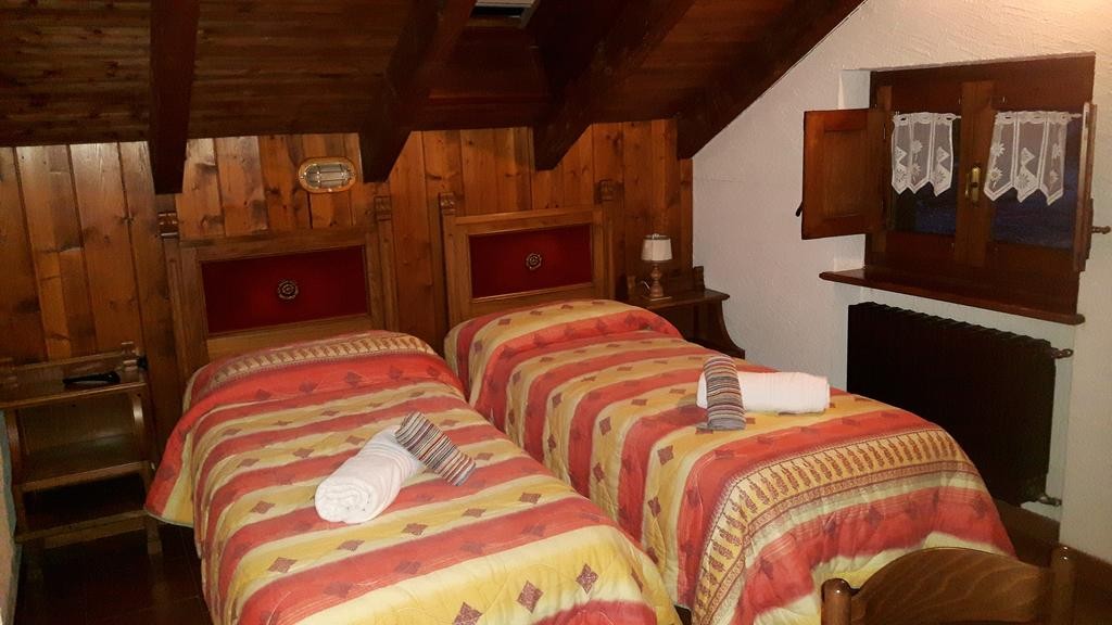
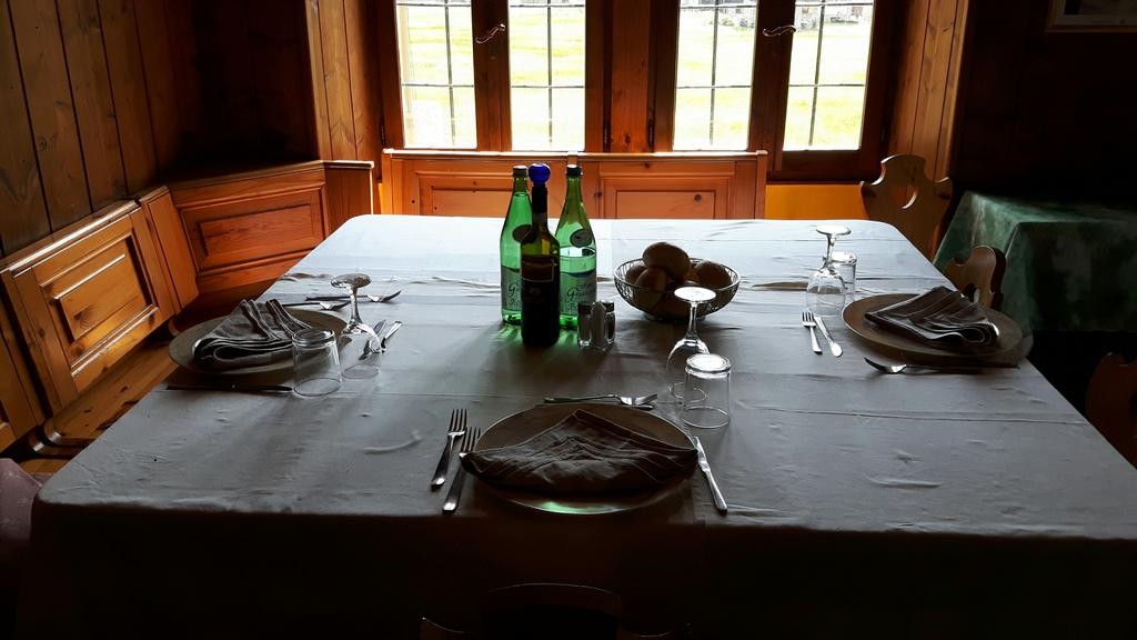
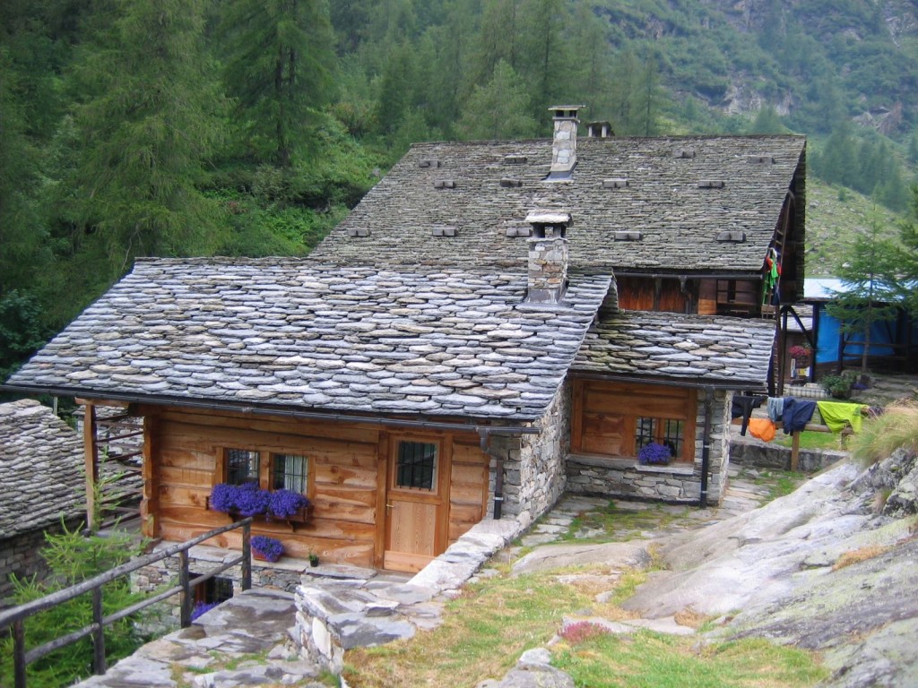
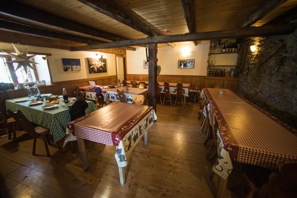
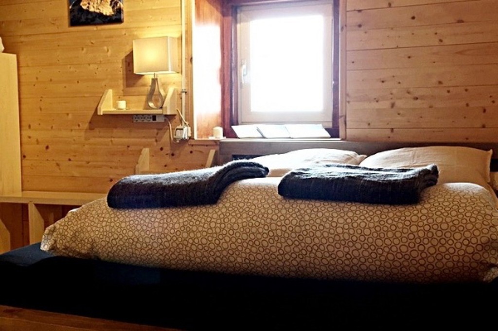
The Casa Alpina de Filippo is a characterful auberge on the outskirts of Macugnaga. This traditional 'Casa' is a lovely overnight with comfortable accommodation. The bedrooms are cosy and some have a balcony. The bedrooms are en suite with private bathrooms. Breakfast is served buffet style, and dinner is typical Italian dishes.
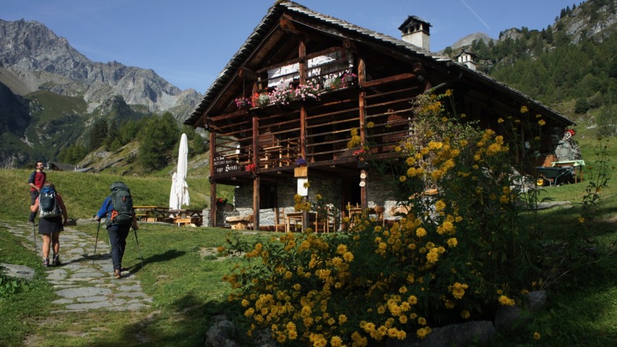
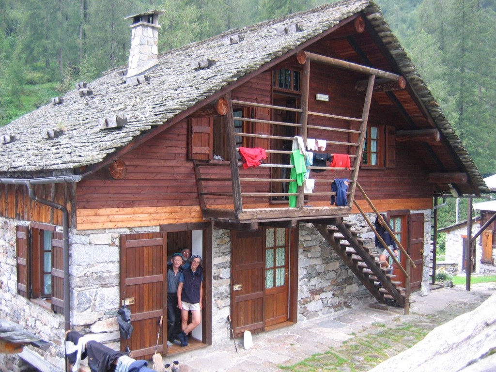
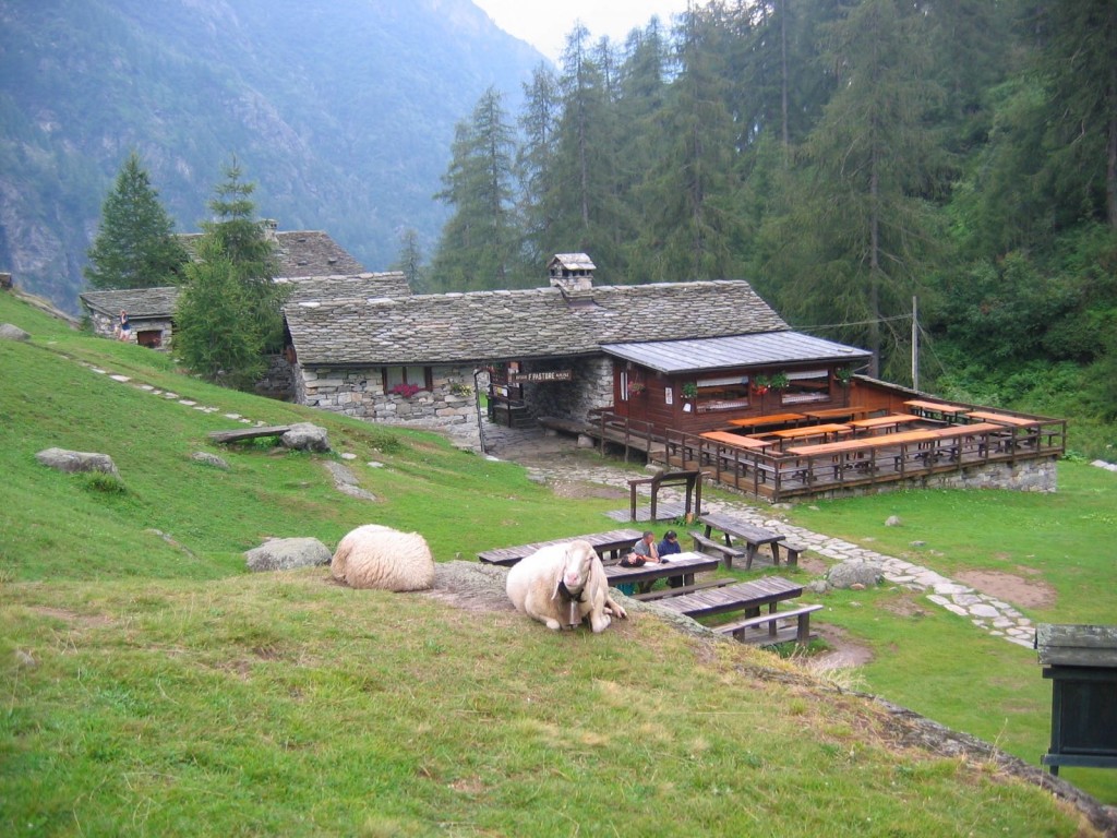
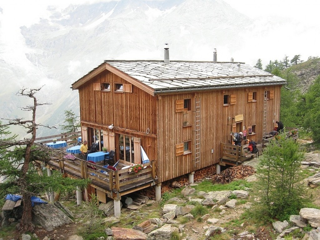
At the end of our trail, and just past the botanic garden, you will find the Rifugio Pastore. Set in a high valley with meadows nearby the Pastore is in a lovely situation. The Rifugio Pastore is one of several renovated mountain huts in the heart of the Alta Valsesia Natural Park. It sits below the spectacular south wall of Monte Rosa.
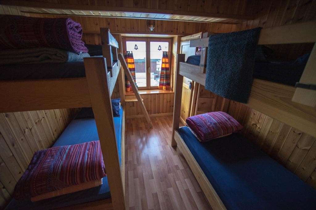
The rigufio sleeps just over sixty people in heated rooms of 4 or 6 beds and has two dormitories, one sleeps 12 and the other 16. Communal bathrooms are available just 20m (65ft) from the rooms which have toilets, wash basins and hot showers.
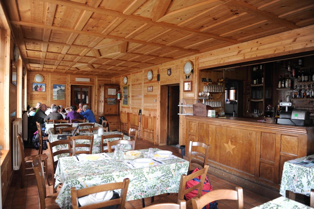
The Rifugio Gabiet is in a lovely situation beside the lake of the same name. After our descent from Col d'Olen a seat on the terrace with a cold drink is very welcome. The Rifugio is cosy and has recently installed new hot water showers, and toilets. It has a dining room, a bar and a living room which is heated by a fireplace and equipped with a small alpine library.
The rooms here have either two or four beds, and are located on two floors. They are equipped with bunk beds, orthopedic mattresses and eiderdowns. All the rooms have central heating.
Our destination tonight is the Rifugio Ferraro in the tiny hamlet of Resy which sits at 2000m (6560ft), and is one of the old Walser villages which flank the Val d’Ayas. The guardians of this refugio are Fausta and Stelio and they are determined that you will enjoy your stay with them. An evening drink watching the sun go down from Resy is one of the best of mountain experiences.
The cosy Ferraro has 26 beds spread out in eight rooms and a dormitory with showers and toilets. The catering service will go far beyond your expectations for a mountain refuge.
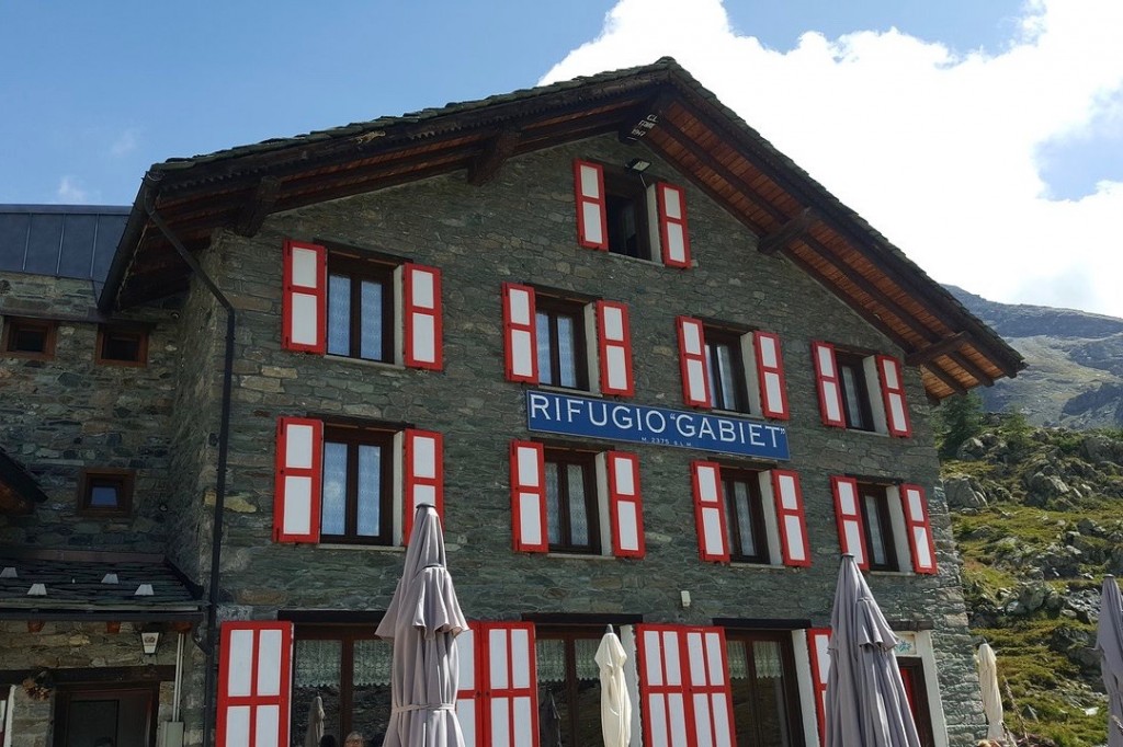
This is the highest point on the trip and it is quite a spot to spend the night. The famous Rifugio Teodulo is perched at 3316m (10,876ft) amidst glaciers, snowy peaks, and the best of all it is right next to the mighty Matterhorn offering absolutely stunning views of this iconic mountain. The rifugio which has recently been renovated is a fine place to spend the evening.
It can sleep up to sixty people in bedrooms which range from 2 people to 8 people. The dining room has an extremely fine view right onto the Matterhorn. A new water pump has been stalled which means the hut now has running water which is pumped all the way up the mountain from Zermatt. There are toilets and one shower (not always available). There are also stoves on each floor to ensure we have some warmth and comfort at this altitude.
At 2,606 metres, the Fluhalp Hutte rests in the heart of the Sunnegga–Blauherd–Rothorn hiking area - a beloved stop for walkers, mountain enthusiasts, and photographers exploring the trails above Zermatt. Easily reached on foot, it’s the perfect place to pause and take in the splendour of the high Alps.
In summer, Fluhalp welcomes overnight guests with cozy rooms and dormitories, offering the rare chance to experience true alpine hut life. Wake to the first light spilling across the summits, set out on nearby high-alpine hikes, and return to the glow of sunset over the glaciers. Just below the hut lies the tranquil Stellisee Lake, where the Matterhorn’s reflection shimmers in the still water - a scene that captures the very essence of the Swiss Alps and one you’ll never forget.
The Europahütte is perched high above the Mattertal and offers spectacular views to the mountains beyond. It is a relatively new hut and offers accommodation based on dormitory rooms. There is a lovely dining room with a sun terrace, and there are hot showers and indoor toilets. It is run by Marcel and his Finnish wife Katja and their three daughters Saskia, Kim and Ellie. In the kitchen they are often all involved in preparing our dinner!
After a long day on the trail it is great to arrive in Grächen and find our lovely accommodation at the Hotel Hannigalp. The hotel has been run by the same family for four generations and they offer a warm welcome. The hotel also has a spa and an indoor swimming pool which is a great way to ease muscles!
The Swiss Alps are easily reached from other European and worldwide destinations by road, rail or plane.
You can book train tickets from any main European city to the town of Visp, and then taking the local post bus to Saas Grund. We recommend using the Trainline to view schedules and book tickets. For other options on travelling by public transport please refer to our travel blog.
If travelling by plane, Geneva, in Switzerland is one of the closest international airports which is easily linked by train to Saas Grund. For train times from Geneva airport to Saas Grund please consult here. This will normally involve taking a train from Geneva, which is very convenient as the train station is within the airport building, getting off at the town of Visp and then taking the local post bus to Saas Grund. The journey from Geneva airport takes approximately 3h30.
Activity, Injury and Mountain Rescue
It is a condition of booking that you are insured against medical expenses, injury, illness, death, cost of repatriation and personal accident risks. For all of our trips your insurance must also cover mountain rescue. The exception to this is if the trip is being held in the United Kingdom or Norway where mountain rescue is free of charge. Please ensure that your insurance covers you to the maximum altitude given on your trip itinerary. The maximum altitude for any trip can be checked on the 'At A Glance' box on each trip page.
Trip Cancellation/Curtailment Insurance
You should also have insurance to cover trip cancellation and curtailment. Insurance should be booked as soon as we have confirmed that your trip is going ahead. Note that your deposit and balance payments are non-refundable unless it is Tracks and Trails who cancel the trip due to a failure to reach the required minimum numbers. In this case we will offer you a refund or the option of transferring to another trip if one is available. We also advise that you should have insurance which covers baggage loss/equipment damage as Tracks and Trails will not be held responsible for loss/damage to baggage/equipment.
It is entirely your own responsibility to ensure that any insurance taken out is appropriate for your trip and for the activity you will be undertaking. Tracks and Trails cannot advise on insurance policies and cannot be held responsible if in the event of a claim your insurance is inadequate.
All of the above insurances are detailed in our Terms and Conditions. For further details, please read the Insurance section on our website.
When packing for a trip in the mountains it is important to have appropriate equipment and clothing. This kit list features items we believe are necessary for the weather you might encounter and accommodation you will be staying in. If you have any questions with regards to what to bring, do not hesitate to get in touch with us.
Drinking Water - on this trip we stay in a number of mountain huts where the only safe source of drinking water is to buy bottled water. As well as being environmentally unsustainable this can also be very expensive. For this reason you may wish to consider a water filtration system. We avoid recommending any specific product and ask that you do your own research into the safest and most efficient system.
Equipment
Clothing
Comfort
Documentation
Personal First Aid
Items for the nights in mountain huts/refuges
Additional Items
**Supplementary snacks if you follow a gluten free or coeliac diet**
Leaders are all first aid trained and will carry their own first aid kit
On many of our trips there will be an element of 'group kit' which will be shared amongst our guests. As mountain people you will be used to team work and working together to the mutual benefit and safety of the group. The 'group kit' will be minimal and usually just a case of sharing a few lightweight 'survival shelters'. For example on a week-long trip you may carry a small shelter for just one day before passing it on to the next person. If you are booking a trip in winter there will be a few additional safety items. These will be distributed in such a way that no one is over burdened. Other group items necessary for safety and comfort will be carried by your guide/instructor.
For each of our trips a minimum number of guests is required before we can confirm that your trip will go-ahead. The minimum and maximum number of guests on your trip is displayed in the 'At a Glance' box on the righthand side of the trip page.
We strongly advise you do not book travel until we have confirmed your trip is 'guaranteed' to run. If you book travel before we have confirmed it is 'guaranteed' we cannot be held responsible for any financial loss if the trip does not go ahead.
When booking a holiday as a solo traveller a twin bedded room comprising of two single beds, is booked as standard. This will be with someone of the same gender unless you request to pay extra for your own room. Single rooms are often limited in supply so if you would like to pay a supplement for a single room we urge you to get in touch as soon as possible. On this trip singles will not be available when we are staying in Rifugios, but may be possible on the hotel nights. This trip has a single supplement of £260 in 2026 and £275 in 2027.
Tracks and Trails go to great lengths to work with first class guides and instructors who are passionate about their work. They are all fully qualified, insured, and hold the correct documentation for the countries that they work in.
Note your guide has complete discretion to make a daily decision on whether or not to take the advertised route based on the weather and the ability of the members of the group. They have our authority to make any route changes they believe are necessary in the interests of safety and enjoyment.
Your hiking guide will be a fully qualified and experienced International Mountain Leader. International Mountain Leaders are not only qualified to ensure the safe management of the group, but are also a source of knowledge about the local flora and fauna, and traditions of the area which you are visiting. You can learn more about our guides and instructors on the About Us page.
On this particular trip there will not be any luggage support. In other words, when we leave on the morning of the first day, you will carry what you need for the entire trip in your rucksack. In reality this is not much more than what you would carry each day, just a few additional items. This type of trip is usually a very satisfying and rewarding experience allowing you to ‘cast aside’ unrequired material possessions for the duration of the trip. We are happy to discuss this with you if you wish to be reassured with regard to which items you need to carry.
Your trip begins and ends at the same hotel and it is possible to leave any unwanted luggage at the hotel for your return.
We do not include lunches in your trip fee for various reasons, the most important of which is food waste. In general our guests have particular tastes and requirements for 'trail' or 'hill' food and it is better you purchase your own snacks rather than throw away items from the picnic lunch which we would supply.
Lunches on our trips are 'picnic' style lunches, in other words you take a packed lunch with sufficient snacks, food and fluid to sustain you throughout the day. Buying snacks and trying local specialities is a great way to inter-act with local people and to practise your language skills.
If there is the possibility of lunch being taken at a restaurant/farm/cafe beside the trail, your guide/instructor will advise you of this. Each evening you can order a picnic or a sandwich from the hotel, or your guide/instructor will advise you of other options such as a local shop or market. In all cases we would ask you to settle any 'bill' for lunch or drinks the evening before you depart, and not in the morning when there may be a queue.
On your itinerary you will find an indication of the amount of ascent and descent you can expect each day. This offers a guideline to how much effort might be expended each day and allows you to decide, based on previous experience, if your fitness and stamina are correct for the trip.
We make every attempt to ensure these statistics are as accurate as possible, but ask you to note that the most modern of technology used to record these details can show considerable variations in terms of ascent, descent, and in particular distance. In other words no two people using GPS devices on the same route will have exactly the same details recorded at the end of the day.
The statistics given should be used as a 'general' indication of the effort required.
Your leader will carry the correct maps and you are not expected to navigate, but if you would like to have maps of the itinerary the one listed below covers the route:
Carte Nationale de la Suisse 5028 T: Monte Rosa Matterhorn 1:50,000
It is useful to arrive at your destination with some cash in the local currency, however, on most occasions it is relatively easy to visit a 'cash machine' after arrival and withdraw money on a credit or debit card. Some of our locations are an exception to this where the accommodation will often have no facilities for withdrawing cash, but they will take a credit card.
On many of our trips we will visit remote cafes/farms where it is wonderful to enjoy a drink and a cake, at places such as these they will often only accept payment in the local currency in cash.
Food
On all of our trips we encourage you to experience local tastes and dishes.
If you are vegetarian catering for your diet is not generally a problem. If you have a 'special' diet because of an allergy/intolerance we would ask that you make your needs clear on your booking form so we can discuss your requirements with the accommodation. A diet that is not related to an allergy/intolerance or beliefs cannot be catered for. It is simply not possible for mountain accommodation to deal with many variations in diet while providing meals for groups.
In addition, if you have an allergy/intolerance we would suggest you bring/purchase suitable snacks as a supplement to the picnic lunches. At times finding gluten free bread, for example, can be an issue. If you would like to discuss the suitability of a trip for a vegan diet, gluten or lactose intolerance please contact us.
We request that you do not CHANGE your dietary requirements during the trip as we will have pre-ordered your meals.
Water
If any of the accommodation has a problem with their water supply they will normally post a sign over the tap indicating that you must not drink the water, otherwise it is normal to drink water from the tap. Hotels - In some countries it is not uncommon for restaurants to charge for tap water at the evening meal. If this is the case then Tracks and Trails will cover the cost. Mountain Huts - If your trip features a stay in a mountain hut/refuge and the tap water is not potable then Tracks and Trails will cover the cost of bottled water at the evening meal. Sparkling water is not included in this option and any cost should be covered by you.
A passport with 6 months remaining validity at the end of your stay is generally required. Please check the relevant embassy or consulate for the country you are visiting, paying attention to your citizenship. It is your responsibility to ensure that you have the correct travel documents and visas for your holiday. Visa requirements and charges are subject to change without notice.
New European Travel Regulations from mid 2025
If you are a guest travelling to one of our European holidays you may be impacted by a significant change to travel regulations expected to be in place from the middle of 2025. The new EITAS scheme will start operating this year and, whilst a start date is not yet confirmed, it is likely to affect our summer holidays in 2025 and any winter holiday thereafter. As your holiday approaches we recommend that you check for updates on the website HERE.
We ask that you carry a paper copy of your passport with you on your trip. We suggest keeping your passport in your rucksack, and a paper copy of your passport in any luggage you might have. If your trip is without luggage transfers then keep a paper copy somewhere in your rucksack, separate from your original document.
We recommend you check if you require an adaptor for your electrical items at:
Plug, Socket & Voltage by Country
Note that if your trip involves staying in a mountain refuge/rifugio/hut that electric sockets may be in short supply and for that night you may not be able to charge any items. Although the accommodation will have electricity this will often be supplied by solar panels or a generator and limited to use by the staff. For this reason we advise that carrying a small slimline and lightweight 'battery pack' can be very useful for recharging phones which many of you will also use as your camera.
Tracks and Trails pays guides/instructors a fair and appropriate fee for their professional service. However, if you feel your guide/instructor has provided an excellent service that went 'above and beyond' then it is at the discretion of each guest whether to tip or not. Guests will often give a tip of between 2 - 5 per cent of the total value of their trip. It is entirely up to you and any gesture will no doubt be appreciated no matter the size.
Before booking consider whether you expect to be in the appropriate physical condition on the date of your departure to allow you to fully participate in and enjoy your holiday. If you have any doubts because of an illness or injury it would be advisable to check with your doctor.
For UK residents travelling to an EU country you should obtain and bring with you a free Global Health Insurance Card (GHIC). This entitles you to state provided medical treatment in certain European countries, but is not a substitute for medical travel insurance.
If you have a UK European Health Insurance Card (EHIC) it will be valid until the expiry date on the card. Once it expires, you’ll need to apply for a GHIC to replace it. The UK Global Health Insurance Card (GHIC) lets you get state healthcare in Europe at a reduced cost or sometimes for free. Please check this before departing. We advise that you always carry your insurance documents with details of the Emergency Medical telephone number for your insurance provider, and your policy number.
We feel strongly about protecting the environment and do not encourage the use of single-use plastic items. We would ask that you arrive with a ‘water bottle’ or ‘hydration system’ that can be used repeatedly. We would point out that we operate a ‘zero tolerance’ for rubbish, and would ask you to remove all your rubbish items from the mountain even those you consider to be bio-degradable. In particular we ask that you remove any toilet tissue.
In the mountains the 'waste water' in refuges (huts) often runs into the nearby streams and rivers with potential impact on the eco-system, though in many places steps are now being taken to avoid this. Whether or not your trip involves staying in a mountain hut we would nevertheless recommend you consider nature friendly sunscreens which only contain mineral UV-blocking ingredients such as oxide, and titanium dioxide.
You can read our full policy here.
Working across international boundaries, and with various currencies means that the price of our trips can change overnight. We have, however, undertaken to guarantee that once you have paid your deposit the price of your trip is fixed. In this respect we urge you to book early to ensure that you receive the price advertised on our website. The website price may increase due to currency fluctuations, but we guarantee that the price advertised on the date of your booking will be maintained in your individual case.
Prices may vary depending on date.
| Dates | Price | ||
|---|---|---|---|
|
Thu 23 Jul - Sun 02 Aug Code: TMR1 |
Price: £2695 | Spaces available | Book |
|
Thu 03 Sep - Sun 13 Sep Code: TMR2 |
Price: £2695 | Spaces available | Book |
| Dates | Price | ||
|---|---|---|---|
|
Thu 22 Jul - Sun 01 Aug Code: TMR1 |
Price: £2800 | Spaces available | Book |
|
Thu 02 Sep - Sun 12 Sep Code: TMR2 |
Price: £2800 | Spaces available | Book |
| From Price | £2695 |
| Holiday Type | Walking |
| Duration | 11 Days |
| Group Size | 4-10 |
| Minimum Age | 18 |
| Maximum Altitude | 3316m (10,876ft) |
| Countries Visited | Italy, Switzerland |
| Meet In | Saas Grund, Switzerland |


